Wow: Impact Map Studies
From College of the Atlantic: a real GIS visualization of the ARG
A public service by College of the Atlantic's GIS Laboratory, Gordon Longsworth and Jenny Rock
I am so impressed with these maps! They do what we have been hoping, and provide the information that neither the PUC, the Maine DEP, or LS Power provided.
Yes, we know the proposed route is changing. When the new routes are released, it will be a pretty quick process to pop them onto these new interactive maps, since The College of the Atlantic team has done such a great job pulling in the land use/land cover and other features of interest in the surrounding areas.
From their website:
The proposed LS Power transmission corridor impacts many natural resources. A more in-depth analysis was performed on the proposed southeast portion of the Gateway corridor. Here are the results.
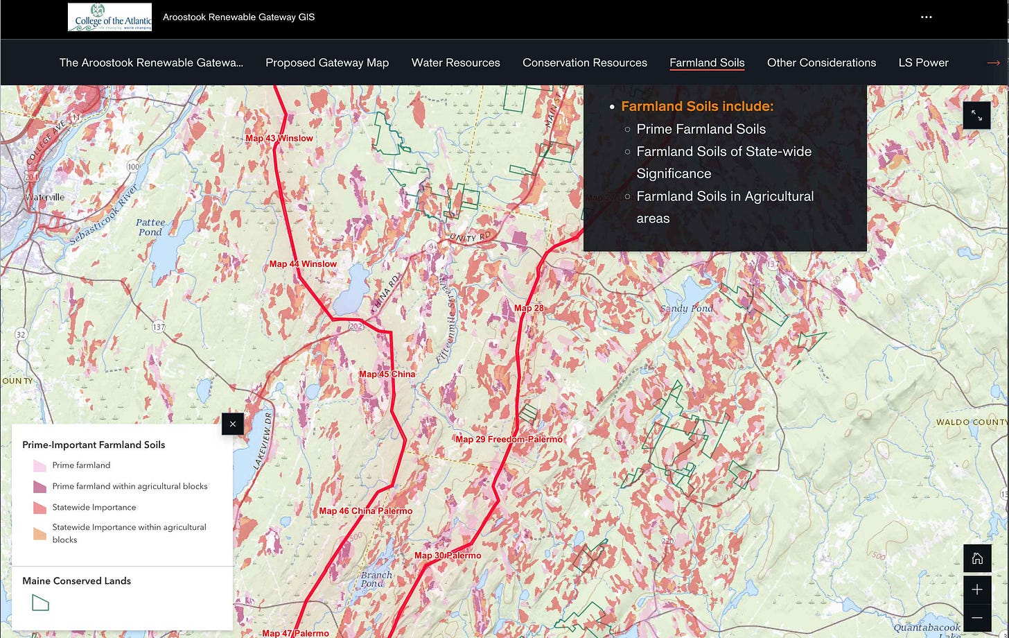
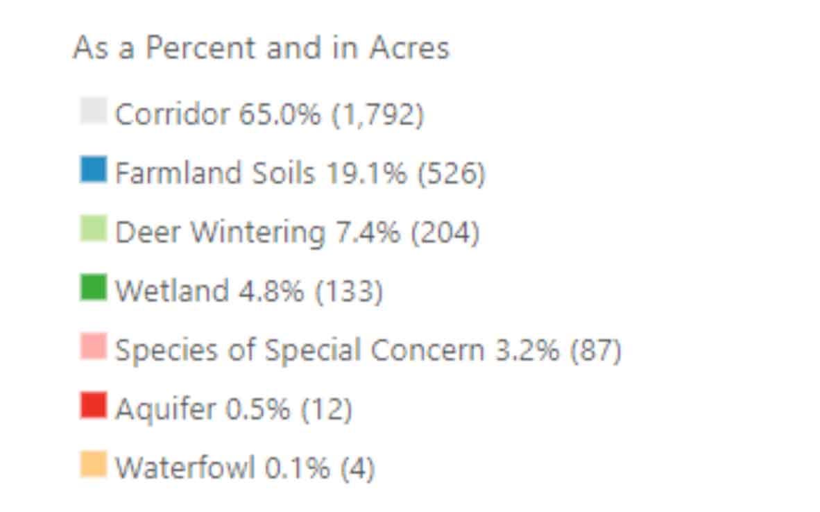
According to State resource maps, more than half (53%) of the southeast proposed gateway would impact farmland. This proposed section of the corridor alone would include 620 acres of either prime farmland soils and/or soils of statewide importance.
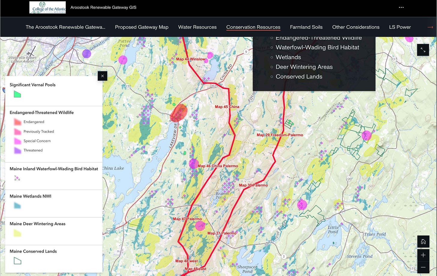
This part of the proposed corridor would also destroy significant amounts of wildlife habitat and biodiversity: 38% of its length would impact wetlands (138 acres including ~ 4 acres of river crossings) as well as 4 acres of designated waterfowl habitat. Another 8% of it would specifically impact known deer wintering areas (210 acres). Most significantly, 8% of the corridor would impact the known habitat of listed species of special concern (constituting ~87 acres of their habitat).
This part of the proposed corridor would also threaten to modify existing aquifers by drilling its pylons across 92 acres of aquifers, including in known PFAS-affected townships.
These statistics show the impacts for just for one of the two possible southern corridor pathways and do not include the enormous northern section. They were calculated using ArcGIS to directly compare the pathway of the proposed SE transmission corridor with State natural resource maps. However, they underrepresent the impacts as many of our resources remain unmapped by the State. The acreage affected was calculated including a conservative "buffer" of 225 feet on each side of the 150-foot pylon pathway (so a 600-foot corridor effect, amounting to 2,760 acres) but this is also likely an underestimation as the effects of the cleared transmission corridor will no doubt extend beyond this.


