Background on the LS Power Gateway Grid Proposed Corridor
Perspective from a farm in Palermo, Maine
Around the end of June 2023 many of my neighbors received letters from LS Power Grid Maine, LLC. These letters stated that my neighbors would be impacted by the proposed corridor, but lacked many specifics. A few weeks later detailed maps were revealed online.
This proposed corridor slices through many heritage, organic, and generational farms and woodlands in central Maine.
There were no dates on any other letters, but people have told me they were received around June 29th, 2023. There are around 3500 abutting land owners in 41 towns. (The number 41 is still uncertain since the map provided by LS Power was not properly labeled.)
The maps provided by LS Power were eventually published on their website here:
http://www.lspgridmaine.com/wp-content/uploads/2023/07/Maine-Property-Mapbook-Letter-Size.pdf
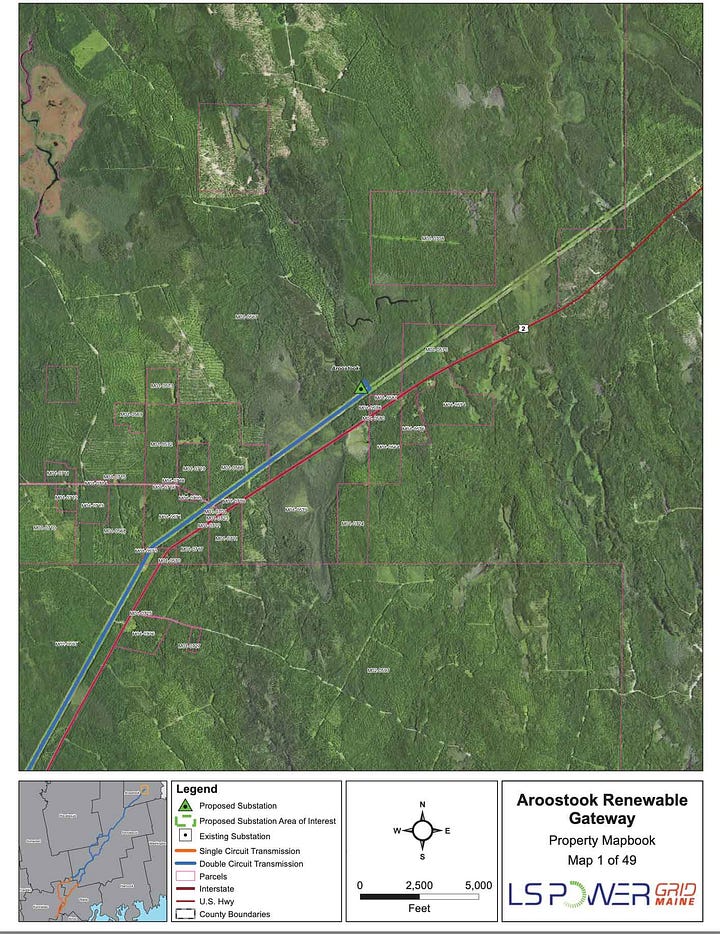
As anyone familiar with map-reading recognizes, these maps are deliberately constructed to make it VERY DIFFICULT for landowners and neighbors to see the impacts. LS Power has refused to release a GIS file or vector file for the proposed routes (to date.)
There are no street names
There are no town names
There are virtually no orientation devices on the maps at all.
The only way to easily determine if a map is of relevance to you is to compare the imagery to google maps visually


So, neighbors began comparing notes and compiling connections. A facebook group was formed.
Non-abutters, such as myself, found out from word of mouth or the slow spread of campaign signs. Note that in the map below, my town Palermo is shown as within the corridor, but not even labeled!


So what is this corridor and why is it being proposed?
December 1st, 2020, Maine's Climate Action Plan was published. The goals:
emit less carbon,
produce energy from renewable sources a
protect our natural resources, communities and people from the effects of climate change.
https://www.maine.gov/climateplan/the-plan
These are admirable goals, no doubt. But Maine already is among the lowest carbon emissions of all the states, whether you look at in absolute or per capita terms! See data on this EIA page / and easily sortable data on this wikipedia page
And are we protecting natural resources by polluting, irradiating and destroying much of the best farmland in central Maine?
The Supporting Legislation:
LD 1679 -An Act to Promote Clean Energy Jobs and To Establish the Maine Climate Council. Enacted by emergency measures, signed into law on 6/26/19 https://www.mainelegislature.org/legis/bills/getPDF.asp?paper=SP0550&item=3&snum=129
In 2021, the Legislature approved §3210-I. Northern Maine Renewable Energy Development Program, which tasked the Maine Public Utilities Commission (MEPUC) with seeking proposals for generation and transmission of “renewable” energy. https://legislature.maine.gov/statutes/35-A/title35-Asec3210-I.html
LD 924 - approves this specific project, and note: it takes use of Public lands off the table. Look at the timeline:
Passed State House around June 8th 2023
Passed State Senate a week later, around June 15th 2023
According to neighbors, legislators who supported LD 924 had never seen a corridor map, and it was implied to them that the corridor had already been purchased or was existing.
June 22nd, letters from LS Power to landowners were postmarked
This means that over the weekend, from June 15th to June 22nd, LS Power created a corridor map, identified all landowners, drafted and printed all their materials, and postmarked them? Unlikely.
The legislation was approved by Gov Mills June 22, 2023.
http://www.mainelegislature.org/legis/bills/display_ps.asp?ld=924&PID=1456&snum=131
Will The Land Be Taken By Eminent Domain?
Eminent domain law https://legislature.maine.gov/statutes/35-A/title35-Asec3136.html
LS Power told attendees at various community events that they don’t want to use eminent domain. And surely, they don’t: it creates an image problem.
When asked, LS Power admitted to using eminent domain in every project done to date. They have done a lot of projects like this one.
Why is this happening in Maine?
If you have been paying any attention to the news, you know that in 2021 there was a public referendum where the people of Maine voted to Stop the CMP Corridor, formally known as New England Clean Energy Connect (NECEC), and then the courts overturned this referendum, despite public and legislative majority support for stopping the corridor.
Our state is being taken over by outside interests. My hypothesis is that this is happening in Maine because we are an elderly, poor, and sparsely populated state. It makes us an easy and desirable target for takeover.
Please note: the rumor from legislators in Augusta is that there are many, many more corridors, wind generation projects, and solar projects slated for development. There is no comprehensive plan, because that makes it too easy for people to organize and oppose it.
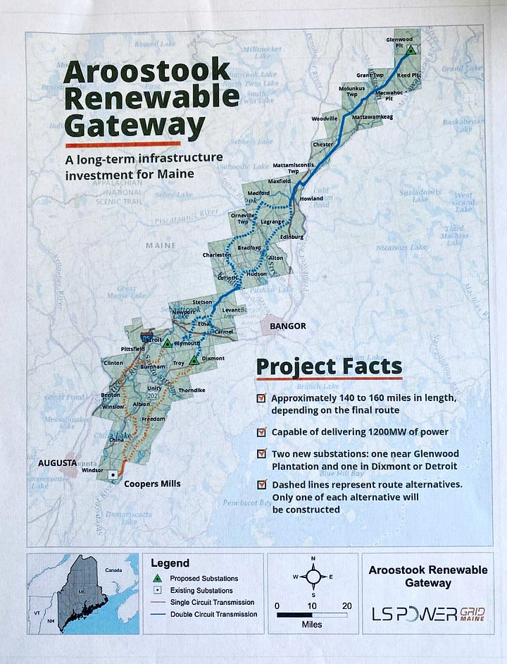
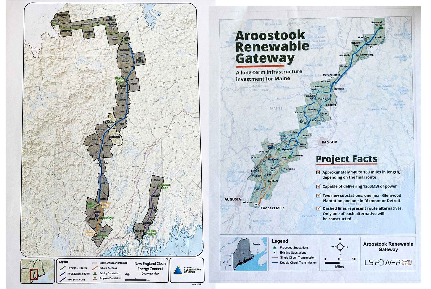
Consider the images below. On the left is the western Maine (aka “Stop CMP Corridor”) route from the 2021 referedum.
On the right is the “Stop Gateway Grid” corridor that was announced this July 2023.
Look closely at the little spit of grid that doesn’t connect to anything in the center of the two pictures.
When the maps are overlaid, what do you discover? It appears that a corridor much like the one proposed in July of 2023 to the people was already in conceptual stages in the “Stop CMP Corridor” era. Is there a comprehensive plan?
And I can tell you what else I found when overlaying these maps: they were created at the same scale despite what the scale bars say. They overlaid perfectly at 100%.
The People of Maine Need to See a Comprehensive Plan.
Power lines through or in view of your property diminish your property value.
A state that encourages taking of land by eminent domain or related property destruction techniques reduces everyone’s property value.
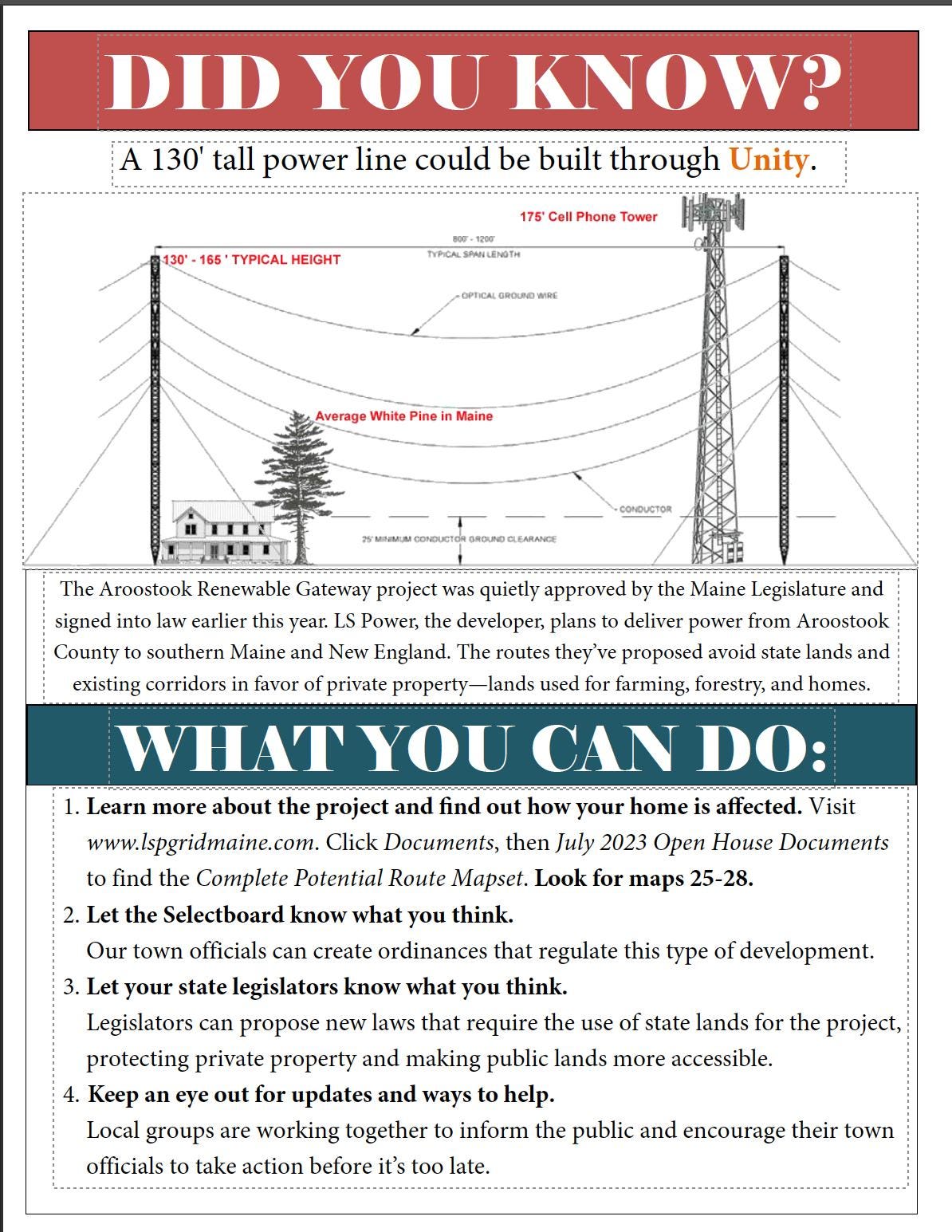
Check out the poster below: 130’ foot is about 13 stories. These poles are huge.
There are unknown and unmeasured impacts from drilling to construct these towers.
There are unknown impacts to wildlife and people from living near these towers.
This could happen in your town next.
Here’s a sense of the scale from a poster made by someone in Unity:
Read this article to understand WHY and HOW the lines can be buried High Voltage DC. There are potentially a dozen corridors in the works and no comprehensive plan. Stop Gateway Grid, we need to plan ahead.
New Hampshire and Vermont are doing it underground: check out the Twin State Clean Energy Link - 75 miles underground.


